
UNITED NATIONS — The United States was the only country to vote against a United Nations General Assembly resolution encouraging wider use of a world map designed to more accurately represent the size of Africa and other continents.
The resolution passed Friday with 164 countries voting in favor. Serbia, Estonia, Georgia, Lithuania, Moldova and Ukraine abstained, leaving the United States as the only nation casting a ‘no’ vote.

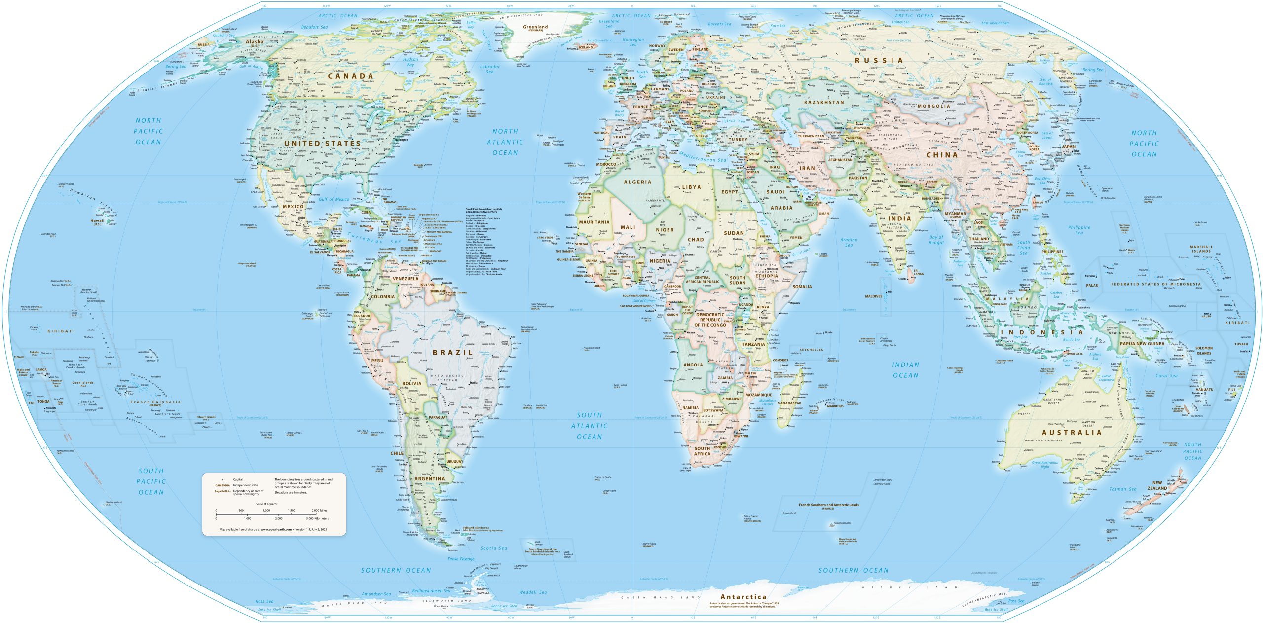
Sponsored by Togo and supported by members of the African Union, the resolution encourages governments, schools, media organizations and international institutions to use the Equal Earth projection rather than relying on the centuries-old Mercator projection. It does not ban the Mercator map or require countries to replace it.
The Mercator projection was created in the 16th century primarily for navigation. While useful for that purpose, it significantly distorts the relative size of landmasses, particularly those closer to the poles.
One of the most striking examples is the comparison between Africa and Greenland. On many Mercator maps, the two appear roughly similar in size. In reality, Africa is about 14 times larger than Greenland.
“Maps shape our understanding of the world,” Togo Foreign Minister Robert Dussey said before the vote. “They guide education, nourish the imagination and influence collective perceptions.”
The African Union Commission called passage of the resolution “a historic step toward accurate and equitable global cartographic representation.”
“For centuries, the Mercator projection distorted global geography, shrinking Africa to the size of Greenland when our continent is actually 14 times larger,” the commission said.
The Equal Earth projection was introduced in 2018 and preserves the relative sizes of countries and continents while maintaining a recognizable world map.
‘Africa No Filter,’ one of the groups campaigning for the change, said it hopes accurate maps will become more common in schools, textbooks, newsrooms, businesses and digital platforms.
The resolution’s passage does not force the United States or any other country to change the maps it uses. Instead, it represents an international recommendation that institutions move toward maps that more accurately depict the relative size of the world’s continents.